We use cookies to ensure our site functions properly and to store limited information about your usage. You may give or withdraw consent at any time. To find out more, read our privacy policy and cookie policy.
Manage Cookies
A cookie is information stored on your computer by a website you visit. Cookies often store your settings for a website, such as your preferred language or location. This allows the site to present you with information customized to fit your needs. As per the GDPR law, companies need to get your explicit approval to collect your data. Some of these cookies are ‘strictly necessary’ to provide the basic functions of the website and can not be turned off, while others if present, have the option of being turned off. Learn more about our Privacy and Cookie policies. These can be managed also from our cookie policy page.
Strictly necessary cookies(always on):
Necessary for enabling core functionality. The website cannot function properly without these cookies. This cannot be turned off. e.g. Sign in, Language
Analytics cookies:
Analytical cookies help us to analyse user behaviour, mainly to see if the users are able to find and act on things that they are looking for. They allow us to recognise and count the number of visitors and to see how visitors move around our website when they are using it. Tools used: Google Analytics
Share Doddi's Beach Coastal Protection Project on FacebookShare Doddi's Beach Coastal Protection Project on X (formerly Twitter)Share Doddi's Beach Coastal Protection Project on LinkedinEmail Doddi's Beach Coastal Protection Project link
Delivering a safer, more sustainable future for one of Mandurah's favourite beaches.
Background
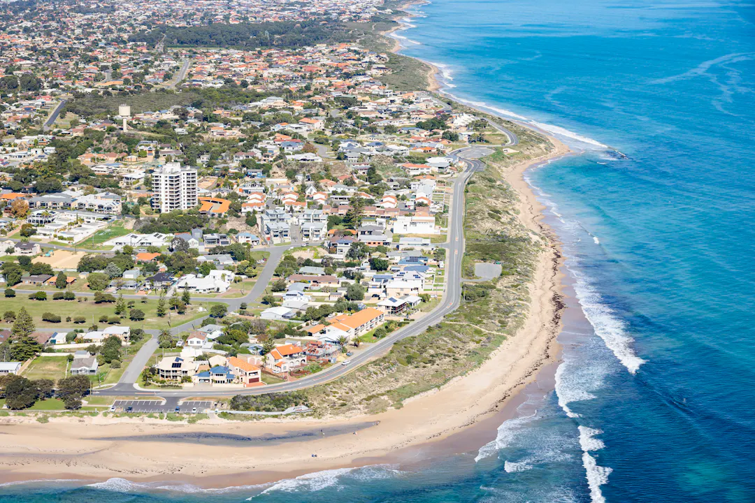
Doddi's Beach has been identified through the Northern Beaches Coastal Hazard Risk Management and Adaptation Plan (CHRMAP) as experiencing significant and immediate coastal erosion risk. The erosion threatens valued coastal assets, public infrastructure and the long-term resilience of this popular section of coastline. The location has also been identified by the State Government as one of Western Australia's 55 coastal erosion hotspots.
To address these risks, the City has completed a Coastal Adaptation Options Assessment and identified a preferred protection solution consisting of:
Construction of a Geosynthetic Sand Container (GSC) bag revetment adjacent to the western car park.
Extension of the existing Janis Street groyne by approximately 20 metres.
Construction of a low-profile GSC groyne between Roberts Point and Janis Street (to be constructed in a future year).
Reprofiling of the beach sand between Roberts Point and Janis Street once sand has built up on the beach
The project is currently forecast to be completed in stages, with the GSC revetment and Janis Street groyne works to be completed in the first stage and the beach reprofiling to be completed in the second stage.
The project aims to manage coastal erosion while protecting the foreshore reserve and associated community infrastructure.
Design has been informed by community feedback received through various coastal engagements including the Northern Beaches CHRMAP and a community petition relating to the management of Doddi's Beach and Roberts Point.
These engagements have helped identify the community values associated with Doddi's Beach and Roberts Point, including maintaining beach access, recreational opportunities, the natural character of the coastline and key foreshore assets.
These values have been considered alongside coastal hazard investigations and technical engineering assessments in the selection of the preferred protection solution.
The project has secured State Government funding at key stages through the Department of Transport and Major Infrastructure (DTMI) Coastal Adaptation and Protection (CAP) Grant program and the Hotspot Coastal Adaptation and Protection (H-CAP) Major Project Fund.
This funding has enabled the City to progress technical investigations, detailed design and delivery planning for the preferred protection solution, supporting implementation of actions identified through the Northern Beaches CHRMAP.
Delivering a safer, more sustainable future for one of Mandurah's favourite beaches.
Background
Doddi's Beach has been identified through the Northern Beaches Coastal Hazard Risk Management and Adaptation Plan (CHRMAP) as experiencing significant and immediate coastal erosion risk. The erosion threatens valued coastal assets, public infrastructure and the long-term resilience of this popular section of coastline. The location has also been identified by the State Government as one of Western Australia's 55 coastal erosion hotspots.
To address these risks, the City has completed a Coastal Adaptation Options Assessment and identified a preferred protection solution consisting of:
Construction of a Geosynthetic Sand Container (GSC) bag revetment adjacent to the western car park.
Extension of the existing Janis Street groyne by approximately 20 metres.
Construction of a low-profile GSC groyne between Roberts Point and Janis Street (to be constructed in a future year).
Reprofiling of the beach sand between Roberts Point and Janis Street once sand has built up on the beach
The project is currently forecast to be completed in stages, with the GSC revetment and Janis Street groyne works to be completed in the first stage and the beach reprofiling to be completed in the second stage.
The project aims to manage coastal erosion while protecting the foreshore reserve and associated community infrastructure.
Design has been informed by community feedback received through various coastal engagements including the Northern Beaches CHRMAP and a community petition relating to the management of Doddi's Beach and Roberts Point.
These engagements have helped identify the community values associated with Doddi's Beach and Roberts Point, including maintaining beach access, recreational opportunities, the natural character of the coastline and key foreshore assets.
These values have been considered alongside coastal hazard investigations and technical engineering assessments in the selection of the preferred protection solution.
The project has secured State Government funding at key stages through the Department of Transport and Major Infrastructure (DTMI) Coastal Adaptation and Protection (CAP) Grant program and the Hotspot Coastal Adaptation and Protection (H-CAP) Major Project Fund.
This funding has enabled the City to progress technical investigations, detailed design and delivery planning for the preferred protection solution, supporting implementation of actions identified through the Northern Beaches CHRMAP.
Share I would like more information on the proposed GSC Groyne between Roberts Point and Janis street. Is this the proposed recommendation by CY O’Connor back in 1901 to avoid the silting up of the entrance to the Peel Estuary and now very public our canals. on FacebookShare I would like more information on the proposed GSC Groyne between Roberts Point and Janis street. Is this the proposed recommendation by CY O’Connor back in 1901 to avoid the silting up of the entrance to the Peel Estuary and now very public our canals. on X (formerly Twitter)Share I would like more information on the proposed GSC Groyne between Roberts Point and Janis street. Is this the proposed recommendation by CY O’Connor back in 1901 to avoid the silting up of the entrance to the Peel Estuary and now very public our canals. on LinkedinEmail I would like more information on the proposed GSC Groyne between Roberts Point and Janis street. Is this the proposed recommendation by CY O’Connor back in 1901 to avoid the silting up of the entrance to the Peel Estuary and now very public our canals. link
I would like more information on the proposed GSC Groyne between Roberts Point and Janis street. Is this the proposed recommendation by CY O’Connor back in 1901 to avoid the silting up of the entrance to the Peel Estuary and now very public our canals.
Paul Fitzpatrick
asked
about 1 month ago
No, the proposed Geotextile Sand Container (GSC) groyne between Roberts Point and Janis Street is not the same as proposed by C.Y. O’Connor, though it is located in a similar area. This proposed groyne’s purpose is to prevent sand erosion along the length of Doddies Beach and to maintain suitable beach width along the western end of the beach. C.Y. O’Connors proposal was related to the migration of sand past the estuary mouth and to the northern beaches.
Northern Beaches CHRMAP 10-Year Action Plan adopted
Doddi's Beach Coastal Protection Project has finished this stage
Council adopted the Northern Beaches Coastal Hazard Risk Management and Adaptations Plan. This is a key strategy that will guide delivery of the Doddi's Beach Coastal Protection Project.
Grant funding secured
Doddi's Beach Coastal Protection Project has finished this stage
State Government Coastal Adaptation and Protection (CAP) Grant funding secured to undertake a Coastal Adaptation Options Assessment.
Detailed Design
Doddi's Beach Coastal Protection Project has finished this stage
Coastal Adaptation and Protection Grant funding secured to complete detailed design of the preferred protection works.
Pre-construction notice period
Doddi's Beach Coastal Protection Project is currently at this stage
Throughout this period, we'll be ensuring frequent beach users, local businesses and surrounding residents are up to date with the latest works timelines.
Construction in progress
this is an upcoming stage for Doddi's Beach Coastal Protection Project
The coastal protection works have begun with construction now in progress.
Construction complete
this is an upcoming stage for Doddi's Beach Coastal Protection Project
Works have now been completed and the construction stage has been finalised.
Thank you for your contribution!
Help us reach out to more people in the community
Share this with family and friends